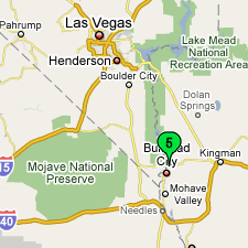
Feb 26-Mar 12 - Bullhead City, AZ
From Palm Springs, we headed east on I-10 before turning northeast and cutting across the Mojave Desert to Needles. The desert scenery is beautiful in kind of an empty, desolate way. From Needles, it's just a few miles north to the twin cities of Laughlin NV and Bullhead City AZ, separated by the Colorado River. We stayed on the AZ side of the river. Bullhead City was originally settled shortly after the Civil War as Hardyville, but became a ghost town in the early 1900's when the railroad went south through Needles. After the Hoover Dam was completed in 1936, many of the construction workers moved to the area anticipating the construction of the Davis Dam, but that didn't start until 1942. Laughlin (pronounced Lauff-lynn) is named after Don Laughlin, who bought an abandoned 12 room hotel in the middle of nowhere in 1964 and opened a hotel and casino. With 13 casinos (and not much else), it's today the third largest casino community in Nevada, and reportedly the 5th most popular US destination for folks in RVs. Laughlin has about 7,000 residents, and is an unincorporated area of Clark County NV, which also includes Las Vegas, some 80 miles to the north. Enough history. Now some touristy stuff. About 8 miles northwest of Laughlin, a couple of miles off the paved road, is Grapevine Canyon. It has to be one of the most extensive Indian petrogylph sites anywhere. We've been to the "big" petroglyph site in Albuquerque, and this is so much more. There are literally thousands of glyphs scratched into the rocks. We hope someone has catalogued the site. The oldest of the glyphs date back to around 600-700 AD; the newest to the early 1900's. It's an absolutely amazing place. "They" call the glyphs "pre-historic", but obviously they're a part of somebody's history, and reportedly chronicle the Indian creation story as well as memorable battles and hunting expeditions.
It's not hard to fathom the appeal of Route 66. There's the spectacular scenery, the song, the tv show, the novel and the movie "Grapes of Wrath", the sound of those hand-picked double digits, and more recently, the movie "Cars". Route 66 had its origins in a military wagon road laid out in 1857 to roughly follow the 35th parallel from Oklahoma to California. It became a national road in 1925, was the first fully paved national There are two neat museums in Kingman, the other being the Kingman Museum of History and Art. Built by an artist who claimed to know nothing about museums, the historical journey of the area is presented in enchanting murals and dioramas unlike any we've ever seen. There's a special area devoted to local boy made good Andy Devine, best known for his role of Jingles, the sidekick of Wild Bill Hickock in both the radio and tv series. And who could forget "Plunk your magic twanger, Froggy!" - from "Andy's Fun House" on the radio back in the late 40s. Neat visit. You can tour both museums for the combined ticket of $3 - gotta be one of the best values on Route 66.
The slideshow for this leg of our adventure contains about 125 images, and you can see it here.
|
 We've not spent much time in the deserts of the American Southwest, so this is a new adventure for us. It's kind of nice to be warm and dry, have some spectacular scenery, and even (we suspect) lose some weight through dessication. We do know that this will rapidly become too much of a good winter thing come spring, and that's why we'll try to be in more temperate places when the deserts heat up.